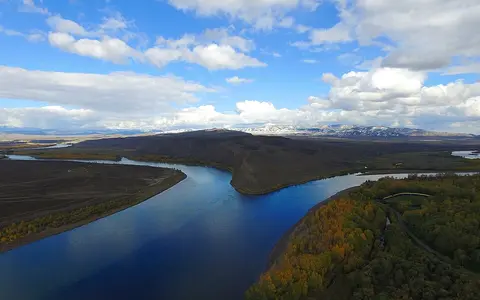

What the Yenisei River is
The Yenisei is one of the principal rivers draining northern Asia to the Arctic Ocean. The river proper begins in the Tuva Basin of southern Siberia at the meeting of the Great Yenisei and Little Yenisei, then runs generally north through Russia to the Kara Sea.
Its drainage network reaches farther than the main stem. Headwaters extend into Mongolia, while the Angara connects the system to Lake Baikal and the Selenga basin. Together with the Podkamennaya Tunguska and Lower Tunguska, these tributaries gather runoff from a broad sweep of the Central Siberian Plateau.
Tuva Basin and Sayan passage
At Kyzyl, the Great Yenisei approaches from the east and the Little Yenisei from the south and southeast. Their confluence occupies an intermontane basin enclosed by the Sayan and Tannu-Ola highlands, giving the young main river a mountain-basin setting before it turns toward lower-relief country to the north.
Leaving Tuva, the river crosses the Western Sayan zone through a narrower, steeper-sided reach. Downstream, it enters the Minusinsk Basin and receives rivers such as the Abakan and Tuba. This alternation between enclosed basins and resistant mountain belts creates a more varied upper valley than the broad lowland reaches farther north.
A north–south line through central Siberia
Beyond the Sayan region, the Yenisei becomes a major north–south drainage axis. Its valley lies near a broad physical divide: lower, flatter terrain of the West Siberian Plain spreads to the west, while the more elevated and dissected Central Siberian Plateau rises to the east.
This asymmetry helps explain the tributary pattern. Several of the largest tributaries arrive from the east after crossing plateau valleys, whereas many western tributaries drain gentler lowland terrain. The contrast is visible in the scale of the Angara, Podkamennaya Tunguska, and Lower Tunguska systems.
Mountain basins and gorges
Intermontane lowlands alternate with confined passages through the Sayan region.
Plateau tributary junctions
Large eastern tributaries greatly expand the main river's flow and drainage reach.
Taiga to tundra lowlands
The valley broadens as relief falls and the river approaches its Arctic estuary.
Angara and Tunguska connections
The Angara is the Yenisei's most important southeastern connection. It is the sole surface outflow of Lake Baikal, so water reaching the lake through the Selenga and other tributaries ultimately joins the Yenisei. This link extends the basin into mountain and basin landscapes well beyond the main river's upper valley.
Farther north, the Podkamennaya Tunguska and Lower Tunguska enter from the right after draining large sectors of the Central Siberian Plateau. Their long, rock-controlled valleys contrast with the wet, low-gradient tributary country west of the Yenisei and reinforce the basin's strongly uneven relief.
Snowmelt, ice, and regulated flow
Seasonal snow storage is a primary control on Yenisei flow. Discharge rises during spring and early summer as snow melts across the basin, with rainfall and mountain meltwater adding to warm-season runoff. The flood wave spreads through the main valley and its side channels as it moves north.
Winter ice cover lasts longer toward the lower river. Because thaw often begins earlier in the south while northern reaches remain frozen, moving water and broken ice can meet intact ice downstream, producing jams and abrupt local flooding. Large reservoirs and hydroelectric dams on the upper and middle Yenisei and on the Angara also modify the natural timing and volume of flow.
Continental seasons and a northward cold gradient
The basin has a strongly continental climate, with cold winters, comparatively warm but short summers, and large seasonal temperature ranges. Mountain position affects precipitation in the south, while vast taiga interiors farther north rely heavily on stored winter snow and summer rain for runoff.
Conditions become colder toward the Arctic coast. Discontinuous and continuous permafrost occupy much of the northern basin, limiting infiltration and shaping slopes, wetlands, and tributary channels. Forest gives way toward forest-tundra and tundra as the river approaches the Kara Sea.
Yenisei Gulf and Kara Sea outlet
Below its major tributary junctions, the Yenisei crosses increasingly subdued northern terrain. The channel broadens, divides around islands in places, and passes through a valley influenced by floodplain storage, permafrost, and a long frozen season.
At the coast, the river enters the Yenisei Gulf, an elongated estuarine arm of the Kara Sea. Freshwater, suspended sediment, and dissolved material spread from the gulf across the shallow Arctic shelf. This outlet places the Yenisei between the Kara Sea drainage of the Ob River to the west and the Laptev Sea drainage of the Lena River to the east.