.jpg)
What the Palau Barrier Reef is
The Palau Barrier Reef is not one continuous wall. It is a discontinuous rim of reef crests, flats, passes, and submerged sections surrounding a large central lagoon and Palau's principal islands. Fringing reefs border some island shores, while patch reefs and shoals break up the lagoon interior.
The system developed on an island platform whose emerged parts include the volcanic island of Babeldaob, smaller volcanic islands, uplifted limestone islands, and low coral cays. This varied foundation gives the reef a more complex form than a simple ring around a single island.
A reef platform on Palau's ocean margin
Palau lies in the western tropical Pacific, east of the Philippines and north of western New Guinea. The main barrier system surrounds Babeldaob, Koror, Peleliu, the Rock Islands, and intervening lagoon waters. Kayangel to the north and Angaur to the south occupy related but more separated reef settings.
The barrier system totals about 260 kilometres, with its greatest continuous north–south reach extending about 170 kilometres from north of Babeldaob toward Peleliu. Its outline is irregular and broken by major channels; broad western and southern tracts contrast with narrower or fragmented eastern margins.
Outer rim, lagoon shelves, and island clusters
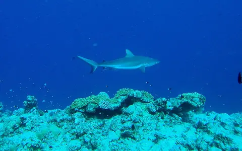
Seaward reef crests absorb much of the incoming swell. Behind them, reef flats pass into lagoon slopes and floors containing patch reefs, sand sheets, deeper channels, and enclosed basins. Openings through the rim range from shallow breaks to navigable passages that focus water exchange.
Within the lagoon, the Rock Islands form a dense group of uplifted limestone remnants with steep, undercut shores and small enclosed or partly enclosed marine basins. Farther north, Babeldaob contributes a much larger high-island mass with weathered uplands, valleys, streams, mangrove-fringed embayments, and fringing reefs.
Reef crest and fore reef
A wave-facing rim grades seaward into a slope that descends rapidly toward deep ocean water.
Lagoon platform
Shallow shelves, patch reefs, channels, sand, and deeper basins separate the outer reef from the islands.
Passes and channels
Breaks in the reef rim connect lagoon water to surrounding seas and organize tidal exchange.
Volcanic uplands, limestone islands, and steep slopes
Palau's reef rests on the upper part of a submarine ridge associated with the complex tectonic margin of the Philippine Sea region. Volcanic rocks form Babeldaob and several nearby islands, while younger limestone records reef growth, uplift, erosion, and repeated shifts in sea level.
Relief changes sharply across short distances. Babeldaob rises to modest but dissected uplands; the Rock Islands form low, rugged limestone towers; reef flats lie close to sea level; and the outer reef slope drops into deep water beyond the narrow platform edge. This steep ocean-facing margin limits the width of any continental-style shelf.
Marine exchange and high-island runoff
Ocean swell drives water across exposed reef crests, while tides and pressure differences move it through passes and channels. The reef rim shelters much of the lagoon from direct swell but does not close it: circulation continually links lagoon basins, island channels, reef flats, and the open Pacific.
Babeldaob's streams deliver freshwater, fine sediment, and dissolved material to nearshore bays after heavy rain. Their influence is strongest close to river mouths and sheltered eastern embayments, then weakens toward outer reefs where ocean mixing dominates. The small limestone and coral islands have far less surface runoff.
Warm seas, heavy rain, and shifting winds
Palau has an equatorial maritime climate with high temperatures, abundant rainfall, and relatively small seasonal temperature changes. The seasonal movement of tropical convergence zones and the western Pacific monsoon changes wind direction, cloud cover, rainfall, and surface-water circulation through the year.
The archipelago lies south of the most frequent western North Pacific typhoon tracks, but tropical cyclones can still bring powerful swell, wind, and rainfall. Storm waves can move sand and coral rubble across reef flats, alter shallow channels, and reshape low cays and exposed shorelines.
Micronesia, the Philippine Sea, and equatorial Pacific water
The reef occupies a transitional western Pacific setting between the Caroline Islands, the Philippine Sea, and seas north of New Guinea. Regional currents, wind-driven surface flow, and deep channels around the island platform connect Palau's steep outer reefs to a much larger ocean circulation system.
Within Geography Atlas, Palau belongs in the reef hub. Its high-island lagoon setting can be compared with the broader barrier system around the New Caledonia Barrier Reef, while its deep-basin island-platform form contrasts with the continental shelf of the Great Barrier Reef and the oceanic atolls of the Maldives Coral Reefs.