Geography AtlasA field guide to Earth
Geography Atlas

Canyons & Valleys

Explore canyons, gorges and valleys through river erosion, glacial landscapes and rock structure, with a guide to reading these connected landforms.

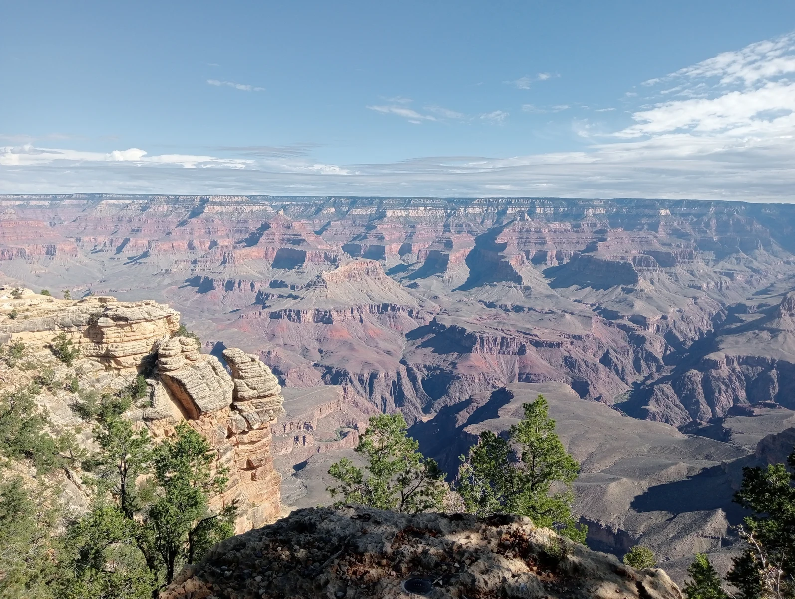
Grand Canyon viewed from Grand Canyon National Park
Terxies · CC0 1.0 · Resized for display

Reading the shape of a valley

A valley is a lower corridor between higher ground. A canyon is a steep-sided erosional valley, often with cliffs; the names canyon and gorge overlap. Shape gives a starting point for understanding a landscape, but it does not tell the entire story. Water, ice and movement of the Earth’s crust can create different kinds of valleys.

In a river-cut canyon, follow the channel and look at the slopes above it. The river can cut downward while tributaries and slope erosion widen the opening. Grand Canyon illustrates the connection between uplift, river incision and exposed rock layers. The age of the rocks is different from the age of the canyon cut through them. Read the National Park Service explanation.

When glaciers reshape an earlier river valley

Yosemite provides a useful comparison. Rivers first cut into its bedrock; later glaciers enlarged the valleys. Moving ice eroded the floor and walls, leaving a broad, steep-sided valley. After the glaciers retreated, sediment partly filled the bedrock basin. Tributary valleys left above the main valley help explain the high waterfalls seen there today.

That sequence matters when reading a photograph. The flat surface of a modern valley floor may be sediment above a much deeper bedrock depression. Cliffs, waterfalls and the present river can reflect several stages of development rather than one event. Explore Yosemite’s geological history.

Explore connected landscapes

This collection brings together named canyons, gorges and valleys. Use the Rivers hub to follow the watercourses that connect them, the Mountains hub for their surrounding relief, and Waterfalls for abrupt changes in channel height. The map directory offers another way to compare the valley floor, surrounding slopes and broader drainage pattern.

When comparing records, check whether a measurement describes the whole valley, one canyon reach or a protected area. These boundaries are not interchangeable.

Sources and further reading

Explore Canyons & Valleys

18 places

Canyon

Black Canyon of the Gunnison

The Gunnison River cuts through an ancient crystalline uplift in western Colorado. The canyon records the interaction of inherited drainage, resistant bedrock, river erosion and continuing slope processes.

Canyon

Blyde River Canyon

Blyde River Canyon cuts into South Africa's eastern escarpment. Its cliffs, tributary junctions and potholes reveal how river erosion interacts with contrasting rock formations.

Canyon

Charyn Canyon

Charyn Canyon combines a river-cut landscape with sedimentary exposures that preserve evidence of Central Asia's changing environments.

Canyon

Colca Canyon

Colca Canyon exposes the geological structure of the western Andes. Its landscape records interactions among tectonic uplift, volcanism, river erosion, glacial processes and slope movement.

Canyon

Cotahuasi Canyon

Cotahuasi Canyon cuts through the western Andes of southern Peru. Its exposed rocks and preserved volcanic deposits record a complex history of uplift, river erosion and valley refilling.

Canyon

Fish River Canyon

Fish River Canyon exposes ancient rocks beneath southern Namibia's plateau. Its shape records river incision and deformation, while episodic floods connect its channel, tributaries and desert pools.

Canyon

Grand Canyon

Grand Canyon exposes ancient rocks in a much younger erosional landscape. Its form reflects Colorado River incision, contrasting rock resistance, tributary drainage and the elevated terrain of the Colorado Plateau.

Canyon

Kali Gandaki Gorge

The Kali Gandaki crosses the Himalayas between Dhaulagiri and Annapurna through a changing sequence of basins and confined gorges. Its landscape records interactions between uplift, river erosion, geological structure and sediment supplied by unstable slopes.

Canyon

Kings Canyon

Kings Canyon cuts into the sandstone country of Watarrka in central Australia. Contrasting rock layers and fractures shape its walls and drainage, while stored groundwater sustains sheltered vegetation.

Valley

Lauterbrunnen Valley

Explore Lauterbrunnen’s glacial trough, limestone cliffs, waterfalls and seasonal drainage, from the valley floor to the Bernese Alps.

Canyon

Sumidero Canyon

Sumidero Canyon links the Grijalva River with the limestone uplands of Chiapas. Its physical geography combines tectonic structure, river incision, karst drainage and reservoir-modified flow.

Canyon

Tara River Canyon

Tara River Canyon cuts through northern Montenegro's Dinaric mountain landscape. Its steep limestone walls connect river erosion, karst drainage and the glacially shaped uplands around Durmitor.

Canyon

Tiger Leaping Gorge

Tiger Leaping Gorge cuts through the Yulong–Haba mountain barrier in northwestern Yunnan. Its relief records the interaction of geological structure, river incision and changing drainage, while neighbouring basins preserve evidence of sediment storage and former glacial influence.

Canyon

Verdon Gorge

The Grand Canyon du Verdon cuts through the limestone uplands of southern France. Its form reflects marine sedimentation, Alpine deformation, river erosion and underground drainage, while its present river regime is influenced by reservoirs.

Canyon

Vikos Gorge

Vikos Gorge cuts through the carbonate rocks of Tymfi in the Pindus Mountains. Its landscape connects tectonic uplift, river erosion, former mountain glaciers and groundwater circulation.

Canyon

Waimea Canyon

Waimea Canyon exposes Kauaʻi’s volcanic foundations and the effects of prolonged erosion. Its contrasting lava sequences, tributary valleys and wet upland catchment explain how the gorge developed.

Canyon

Yarlung Tsangpo Grand Canyon

At the eastern end of the Himalaya, the Yarlung Tsangpo cuts through exceptionally high relief. Its gorge records interacting processes of rock uplift, river erosion, sediment burial and glacial disruption.

Valley

Yosemite Valley

Yosemite Valley combines a deeply eroded granitic basin with a sediment-filled floor still reshaped by the Merced River, tributary streams and rockfalls.