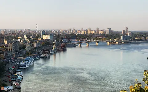

What the Dnieper River is
The Dnieper is one of the principal rivers draining the East European Plain. Its basin extends across parts of Russia, Belarus, and Ukraine, and its main channel follows a generally southern course. The river connects inland uplands and extensive low-relief plains with the Black Sea coastal margin.
Physically, the Dnieper is a long river system rather than a uniform channel. Its upper reaches are relatively narrow and winding; its middle course receives major tributaries and crosses broad valleys; and its lower course is dominated by reservoir reaches, floodplain remnants, and an estuarine outlet.
From the Valdai Hills to the Black Sea
The river rises in the southern Valdai Hills, a gently elevated headwater region that also feeds other major European drainage systems. Small streams gather among forests, wetlands, and glacially influenced terrain before the upper Dnieper turns south through western Russia and eastern Belarus.
Farther downstream, the river enters Ukraine and follows a broad lowland corridor toward the Black Sea. The course links three broad landscape belts: the more humid forest zone upstream, mixed forest-steppe through much of the middle basin, and drier steppe terrain toward the lower river and coast.
A river organized by low relief
Most of the Dnieper basin lies on the East European Plain, where gradients are modest and major mountain barriers are absent. Broad interfluves separate the river from neighboring basins, while regional uplands guide tributaries toward the main channel. The middle river broadly separates the higher, more dissected right bank from lower and more gently sloping terrain to the east.
Before regulation, the river included rapids where its channel crossed resistant crystalline rocks of the Ukrainian Shield. Reservoir construction submerged these reaches and transformed long sections into broad, slow-moving impoundments. Even so, the contrast between upland tributary valleys, wide floodplain sectors, and the low coastal plain remains central to the basin's form.
Valdai Hills
Low uplands, wetlands, and forest streams feed the young river.
Broad plain and tributaries
Regional uplands and lowlands organize a large, asymmetric drainage network.
Steppe and estuary
Reservoir reaches descend toward a low plain and a Black Sea liman.
Tributaries, snowmelt, and regulated flow
The Dnieper receives an extensive tributary network. Important tributaries include the Berezina and Pripyat from the west and the Sozh, Desna, Sula, Psel, and Vorskla from the east. The Pripyat connects the main river to a large wetland lowland, while the Desna supplies a substantial part of the middle river's flow.
Seasonal snow accumulation and spring thaw have traditionally produced the main annual high-water period. Rainfall supports flow during warmer months, and groundwater helps maintain the river during lower-flow periods. A cascade of large reservoirs now stores and redistributes water, moderating some seasonal variation while expanding open-water surfaces and altering sediment movement.
Continental controls across the basin
The basin has a temperate continental climate, with cold winters, warm summers, and stronger moisture availability toward the north. Winter snow cover is a major hydrologic store. Rapid thaw can send water into frozen or saturated ground and channels, producing a pronounced spring rise.
Southward, rainfall generally becomes less reliable and evaporation increases across the forest-steppe and steppe. This climatic gradient helps explain why much of the river's runoff is generated in the upper and middle basin even though the main channel continues far across the drier southern plain.
Floodplain, liman, and coastal connection
Below the reservoir cascade, the Dnieper enters a low-gradient southern plain. Historically, the lower valley contained a broad complex of side channels, islands, wetlands, and seasonally inundated floodplain. Regulation has reorganized much of this setting, but the remaining lower channels still reflect a river approaching base level at the coast.
The Dnieper does not end in a projecting delta comparable to those of some sediment-rich rivers. Instead, it enters the Dnieper–Bug liman, a broad, shallow estuarine basin shared with the Southern Bug River. The liman opens toward the northwestern Black Sea, completing the river's transition from continental drainage basin to enclosed coastal water.
A basin between neighboring watersheds
The Dnieper basin is bordered by other major European drainage systems. Low divides separate its headwaters and tributaries from rivers flowing toward the Baltic Sea, while eastern and southeastern divides separate it from the Don basin. To the west, the basin approaches the drainage of the Dniester and other Black Sea rivers.
These subdued divides make the river part of a wider continental pattern: broad plains, rather than mountain walls, direct water toward different seas. The Dnieper is therefore a useful reference for understanding how low relief, climate gradients, wetlands, and tributary networks organize eastern Europe's surface drainage.