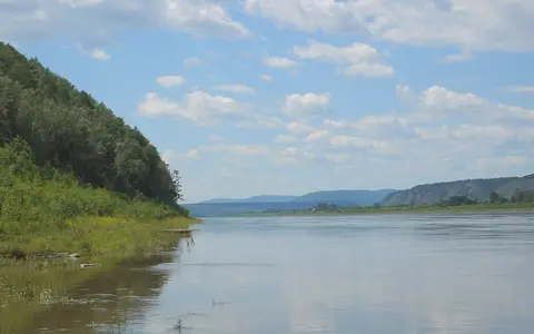

What the Amur River is
The Amur begins at the meeting of the Shilka and Argun rivers. From this confluence it follows a broad arc eastward and then northeastward across the continental margin of northeast Asia, reaching the lowlands opposite Sakhalin near the Sea of Okhotsk.
The river is best understood as a basin-scale system rather than a single channel. Its drainage network connects the Mongolian Plateau and Transbaikal uplands, the Greater Khingan and other mountain margins, the plains of northeastern China, the lower Amur lowland, and a tidal outlet where river water meets a restricted coastal sea passage.
Shilka and Argun headwaters
The named Amur forms where the Shilka approaches from the west and the Argun from the south. The Shilka drains mountain and basin terrain in Transbaikalia, while the Argun system reaches toward the drier plateaus and grasslands of the continental interior.
These source branches place the upper basin in a landscape of pronounced seasonal temperature ranges and uneven moisture. Valleys and intermontane basins guide the headwaters before the combined river enters a succession of border valleys, bends, and widening alluvial reaches.
Mountain margins and lowland corridors
Relief divides the basin into distinct drainage compartments. Mountain ranges steer many tributaries and locally confine the main river, while downstream plains allow the channel to widen, split around islands, migrate across alluvium, and exchange water with floodplain lakes and wetlands.
The Zeya and Bureya carry runoff from northern uplands. The Songhua drains a large part of northeastern China, and the Ussuri enters from the south along another lowland border corridor. Together these tributaries expand the Amur from an interior headwater river into the main drainage axis of the region.
Shilka–Argun confluence
Two long source branches unite between uplands near the western end of the named river.
Zeya, Songhua, and Ussuri
Major tributaries connect northern mountains and northeastern Chinese plains to the main stem.
Amur estuary
The lower river enters a shallow tidal transition linked to the Sea of Okhotsk.
Summer floods and winter ice
The Amur differs from many north-flowing Siberian rivers because summer rainfall is a dominant control on discharge. Moist air from the Pacific margin and the East Asian monsoon brings much of the basin's precipitation during the warm season, when prolonged rain and storms can raise the main river and its tributaries across broad floodplains.
Snowmelt adds an earlier seasonal rise, but rainfall can produce the larger and more variable floods. In winter, low temperatures freeze much of the river, reduce flow, and store precipitation as snow. This combination creates a marked annual rhythm between frozen low-water conditions and warm-season flood pulses.
Continental interior and Pacific influence
The basin crosses a strong climatic gradient. Western headwater country is comparatively dry and continental, with long cold winters, while the middle and lower basin receives greater warm-season moisture from Pacific weather systems. Mountain relief redirects air masses and produces local differences in precipitation and runoff.
Seasonal freezing remains important throughout much of the basin, but the lower river is more directly connected to humid forest lowlands and coastal conditions. The contrast between winter continental cold and summer monsoon rainfall governs channel flow, floodplain saturation, sediment movement, and the timing of ice formation and breakup.
Floodplain lakes and coastal outlet
Below its major tributary junctions, the Amur crosses a low-gradient plain with side channels, islands, marshy depressions, and lakes connected to the river during high water. These surfaces store floodwater and sediment, so the lower river occupies a wider hydrologic corridor than its main channel alone.
Near its mouth, the river enters the Amur estuary west of northern Sakhalin. From there water reaches the Sea of Okhotsk and also connects southward through the narrow waters between Sakhalin and the mainland. The shallow, tide-influenced outlet is therefore a complex transition rather than a simple open-coast delta.