
What the Raja Ampat Reefs are
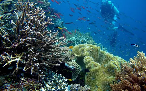
Raja Ampat is a broad reef region rather than a single named reef structure. Coral construction occupies the shallow margins of four large islands—Waigeo, Batanta, Salawati, and Misool—and a dense scatter of smaller islands, rocks, cays, submerged banks, and shoals.
Its defining geography is the close fit between reefs and a fragmented archipelago. Fringing reefs narrow beneath steep coasts, patch reefs occupy protected sounds and shelf surfaces, and current-swept reef ridges develop beside passages linking the surrounding seas.
At the western edge of New Guinea
The reefs lie in Southwest Papua province, Indonesia, immediately west and northwest of the Bird's Head Peninsula. Waigeo occupies the north, Batanta and Salawati lie nearer the New Guinea coast, and Misool forms the large southern island group.
The archipelago lies between several named marine regions: the Halmahera Sea opens to the west, the Seram Sea lies south of Misool, and waters around Waigeo connect toward the Pacific-facing seas north of New Guinea. Dampier Strait separates Waigeo from Batanta, while narrower passages divide many outer groups.
Island margins, reef platforms, and channels
Reef form changes with exposure and substrate. Fringing reefs follow hard island shores; patch and platform reefs occupy shallow water between islands; reef flats and crests face incoming waves; and protected embayments contain quieter shallow-water surfaces. These units repeat across the archipelago without joining into a single continuous barrier.
Limestone is especially visible in the smaller karst islands of northern and southern Raja Ampat. Dissolution, marine erosion, and changing sea levels have produced steep-sided islets, notches, enclosed inlets, and flooded passages. Elsewhere, larger mountainous islands provide longer coasts and short drainage basins beside the reefs.
Waigeo and Wayag
Large-island coasts and clusters of limestone islets create irregular reef margins and narrow passages.
Dampier Strait
A constricted marine corridor between Waigeo and Batanta concentrates tidal exchange around islands and shoals.
Misool platform
Karst island groups, bays, channels, and reef shelves face the Seram Sea and deeper southern waters.
A shelf-and-basin transition
Much of Raja Ampat rests on the western extension of the Sahul Shelf, the submerged continental margin shared with New Guinea and Australia. That foundation supplies broad shallow areas where islands, banks, and reefs are closely spaced, but the shelf is dissected and does not produce uniform depths.
Local relief ranges from reef flats exposed to strong wave action to steep submarine slopes beside channels and outer island margins. Above water, mountainous interiors on the four large islands contrast with low cays and sharply sculpted limestone islets, linking terrestrial runoff, coastal sediment, and marine relief within short distances.
Tides and currents through island passages
The broken arrangement of islands channels tidal water through straits, reef gaps, and passages. Dampier Strait is the clearest example: water moving between regional seas is narrowed between Waigeo, Batanta, and their adjacent islets, producing locally strong flow over reef ridges and around headlands.
Hydrology also varies from exposed outer slopes to sheltered bays. Rain drains through short streams on the larger islands and directly from steep small-island catchments, so freshwater and sediment effects are strongest near land after heavy rain. Offshore reefs and flushed channels remain more directly governed by tides, waves, and regional circulation.
Equatorial heat, rainfall, and shifting winds
Raja Ampat lies close to the equator and has a warm, humid maritime climate. Rain falls in every season, supporting dense vegetation and frequent runoff from the larger islands. Seasonal shifts in regional winds alter which coasts and passages receive the strongest wave exposure.
The archipelago sits outside the main belts of frequent tropical-cyclone landfall, but swell, squalls, heavy rainfall, and monsoon-season seas still move sediment and coral rubble. Climate effects are filtered by orientation: outer reefs receive open-sea energy while leeward bays and karst channels are more sheltered.
Bird's Head, Halmahera, and the Coral Triangle
Raja Ampat forms the western marine edge of New Guinea and the northwestern part of the wider Bird's Head Seascape. Its channels connect eastern Indonesian seas across a structurally complex zone where the Sahul Shelf approaches island-arc and deep-basin terrain.
Within the reef hub, Raja Ampat contrasts with the isolated atolls of the Tubbataha Reefs and the continuous coast-parallel form of the New Caledonia Barrier Reef. Its closest comparison is an island-shelf mosaic in which landforms, passages, and reef patches must be read together.