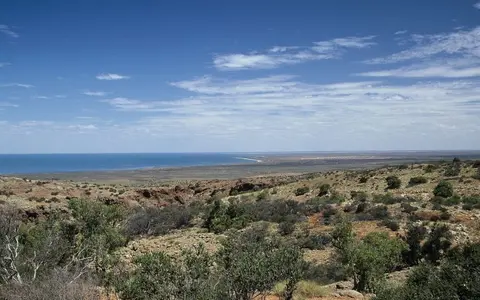

What Ningaloo Reef is
Ningaloo is a coast-parallel complex of coral reef, reef flats, channels, patch reefs, and lagoon floor. Its central reach behaves like a barrier because a lagoon separates the main crest from land, but its proximity to shore and direct attachment at intervals make fringing reef the more useful broad classification.
The reef is part of a larger coast-to-ocean system. Sandy beaches, rocky headlands, tidal inlets, and the Cape Range peninsula form its landward edge; beyond the crest are the outer shelf, shelf break, continental slope, and deep Indian Ocean. These closely packed terrain zones give Ningaloo a strong cross-shore relief pattern.
Along the North West Cape
The reef follows Western Australia's Gascoyne coast, beginning around the North West Cape near Exmouth and continuing south past Coral Bay. The northern section faces west and northwest from the Cape Range peninsula; farther south, the coast and reef trend generally southwest along the eastern margin of the Indian Ocean.
North West Cape separates the open-ocean reef coast from Exmouth Gulf to the east. That bend in the coastline is geographically important: the reef's wave-exposed Indian Ocean margin, the sheltered gulf, and the limestone peninsula occupy adjoining but distinct physical settings.
Crest, lagoon, passes, and patch reefs
The principal reef crest forms a broken, shallow rim offshore. Waves release much of their energy on its ocean-facing margin, while water crosses low parts of the crest and moves through named and unnamed passes. Landward of the crest, a lagoon generally a few hundred metres to several kilometres wide contains sandy and carbonate floors, coral patches, channels, and shallow banks.
The system is not uniform from end to end. A long central barrier-like tract gives way to more discontinuous fringing and patch reefs toward its northern and southern limits. Local gaps allow ocean water to enter the lagoon, and channel mouths concentrate its return flow.
Shallow lagoon
Protected water, channels, patch reefs, and sandy floors occupy the narrow space between beach and main crest.
Reef crest and slope
A wave-exposed crest marks the seaward edge before the reef front descends toward deeper shelf water.
Passes and channels
Breaks in the crest connect lagoon circulation with tides, waves, and shelf currents offshore.
A steep ocean margin close to shore
Off Cape Range, the continental shelf is exceptionally narrow: between Point Murat and Coral Bay it is generally less than 10 kilometres wide. The shelf break therefore lies close to the reef, and the seafloor passes rapidly from shallow lagoon and reef surfaces to outer-shelf water, a steep continental slope, canyons, and the deep ocean.
The shelf broadens southward and can extend more than 30 kilometres from shore at the southern end of the region. This change means that Ningaloo is not one repeated cross-section; its northern reaches have a compressed coast-to-slope profile, while southern reaches occupy a wider shelf setting.
Ocean water exchanged through a narrow lagoon
Waves, tides, wind, and shelf currents drive Ningaloo's water movement. Ocean swell breaks on the crest and pushes water across it into the lagoon. Water then travels along the lagoon and returns seaward through reef passes, producing local differences in current speed, residence time, and sediment movement.
Freshwater input is limited because the adjacent coast is arid and has no large perennial rivers. Short drainage lines descend from Cape Range, but runoff is episodic. Low river discharge and limited fine sediment help explain why coral reef has developed so near the mainland, while groundwater and occasional flood flows still connect the limestone catchments with the coast.
Aridity beside a warm boundary current
The Ningaloo coast has a hot, dry climate shaped by subtropical high pressure, the surrounding ocean, and sparse, irregular rainfall. Evaporation is high, summer heat is pronounced, and tropical cyclones can bring intense rain, storm surge, large waves, and sudden coastal reworking.
Offshore, the south-flowing Leeuwin Current carries warm water along Western Australia and is strongest near the coast in autumn and winter. Seasonal winds can also support the northward-flowing Ningaloo Current and localized upwelling along the shelf. Their interaction transports heat and water masses along the reef and links the shallow lagoon to the wider eastern Indian Ocean.
Cape Range, Exmouth Gulf, and the Indian Ocean
Immediately inland, Cape Range is an uplifted limestone peninsula cut by gorges and underlain by caves, conduits, and groundwater. Wave-cut terraces and older reef limestones record former sea levels. The modern reef and the karst range are therefore neighboring parts of a longer history of carbonate deposition, uplift, erosion, and changing coastlines.
North West Cape connects Ningaloo's open coast with Exmouth Gulf, while the outer shelf connects it to deeper canyons and Indian Ocean circulation. Within Geography Atlas, Ningaloo belongs in the reef hub; its narrow fringing setting contrasts with the broad shelf province of the Great Barrier Reef and the ocean-basin atolls of the Tubbataha Reefs.