One chain, several definitions
Regional references place the chain mainly in Bulgaria but include a western sector in eastern Serbia. The Croatian Encyclopedia describes several linked chains about 550 km long and 20–50 km wide, from the lower Timok to the Black Sea. A Bulgarian Academy of Sciences habitat synthesis instead gives 530 km and explicitly groups the Fore-Balkan with the main range (Red Data Book of Bulgaria). Neither source states a reproducible line-measurement method, so this page retains “about 550 km” and does not combine the figures into a false-precision average.
Stara Planina can also mean a narrower Serbian morphological unit. A 2022 study bounds that Serbian unit by the Beli Timok and Trgoviški Timok valleys to the north and northwest, the Visočica valley to the south and southwest, and the Bulgarian border to the east; it reports a nearly 100 km north–south extent and 1,802 km² area. Its highest summit is Midžor at 2,169 m; the encyclopedia’s 2,170 m is the same value rounded to ten metres. These Serbian-unit dimensions must not be substituted for the whole transboundary chain. (Marjanović et al., 2022)
High central massifs between lower, dissected ends
Bulgarian geographic usage divides the main range into Western, Central, and Eastern sections. The central section is both the narrowest and highest: the Bulgarian Red Data Book gives a local width of up to 15 km in its high part, and Botev reaches 2,376 m above sea level. The elevation and the WGS 84 position in the stat card come from the Botev Peak meteorological-station record; the cited sources do not identify the vertical datum behind the published elevation. (Nikolova et al., 2026)
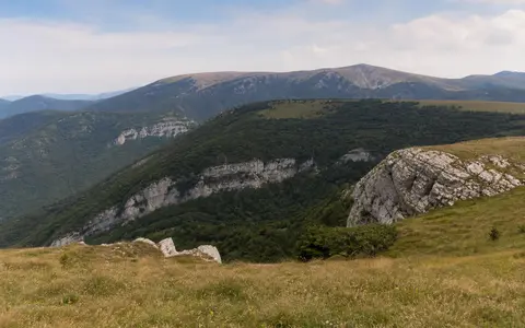
Relief is asymmetric but not uniformly so. Inside Central Balkan National Park, the southern mountain front is generally steep while the northern side descends through gentler slopes and gorges; this park-scale pattern should not be projected unchanged along all 550 km. South of the central crest, the Karlovo and Kazanlak sub-Balkan basins separate Stara Planina from Sredna Gora. To the north, the Fore-Balkan is a lower belt of ridges, plateaus, and structural depressions leading toward the Danubian Plain. (Association of Parks in Bulgaria)
Botev: 2,376 m
The published figure is an elevation above sea level, not prominence or height above the surrounding basins.
Midžor: 2,169 m
The 2022 study reports metres above sea level; some reference works round this to 2,170 m.
Segmented, not one crest
Passes, transverse valleys, basins, and named subranges interrupt the regional west–east alignment.
Inherited rocks, two compression stages, later exhumation
The topographic range overlaps the axial Stara Planina zone of the Balkanides, but the two are not identical boundaries. The Balkan fold-thrust belt developed along the southern margin of the comparatively stable Moesian Platform. Thrusts generally transported rock northward: in the eastern belt, deformation is mainly thin-skinned, meaning sedimentary cover moved above a detachment without much deep basement; westward, thick-skinned structures incorporate older basement rock. (Vangelov et al., 2013)
This structure did not form in a single event. Thermochronologic and structural work identifies one compressional stage from the Middle Jurassic to Early Cretaceous and another from the Late Cretaceous into the Paleogene. Low-temperature mineral systems in Central Stara Planina then record cooling and exhumation at approximately 44–30 million years ago and again at 25–20 million years ago. Those dates measure rock cooling during unroofing; they are not the “age of the mountains.” (Kounov et al., 2018)
The varied relief follows this mixed inheritance. Paleozoic metamorphic and granitic basement appears in western and central thrust sheets, while Mesozoic limestones and other sedimentary rocks form scarps, plateaus, and structurally guided valleys. Eastern sections contain younger deep-marine sandstone, siltstone, marl, and limestone successions. Folding, faulting, differential rock resistance, river incision, and slope erosion therefore produce different landform styles along the chain.
Carbonate rock reroutes water underground
Karst is terrain formed where water dissolves carbonate rock, creating enclosed depressions, caves, shafts, springs, and underground drainage. A 2003 national synthesis estimated that karst occupies about 20% of Stara Planina and is developed mainly in Triassic and Cretaceous carbonate units. It recognized 19 cave regions in the range. Both values reflect the mapping and cave-region scheme available in 2003, not a new inventory. (Angelova, 2003)
Karst changes how the mountains release runoff: surface streams can lose water into fractures, while springs return stored groundwater to valley systems. It also helps explain why limestone sectors have concentrated caves and deeply incised gorges rather than the broad summit forms seen on some crystalline massifs. The Iskar corridor combines river incision with folded and faulted carbonate terrain, but the river’s trans-range course is a regional drainage exception, not evidence that the main crest lacks watershed importance.
Three receiving systems and one major cross-range river
Across much of central Bulgaria, the main crest separates Black Sea drainage through the Danube from Aegean drainage through the Maritsa system. In Central Balkan National Park, the Vit, Osam, and Rositsa run northward toward the Danube system, while the Topolnitsa, Stryama, and Tundzha drain southward or southeastward toward the Maritsa and Aegean. The park describes a snow–rain regime with high water in spring and low water in autumn; that seasonal statement applies to its central headwaters, not automatically to every river along the range. (Central Balkan park profile)
The Iskar is the conspicuous exception. It rises in Rila south of Stara Planina, flows through the Sofia Basin, cuts north across the mountain belt in the Iskar Gorge, and joins the Danube. The International Commission for the Protection of the Danube River identifies the Iskar alongside the Ogosta, Vit, Osam, and Yantra among Bulgaria’s principal Danube-basin tributaries. (ICPDR country profile)
Eastern Stara Planina also drains directly to the Black Sea. Bulgaria’s Black Sea Basin Directorate reports that the Kamchiya and its tributaries occupy the area between branches of the East Balkan Mountains; the Golyama Kamchiya and Luda Kamchiya combine into a system with a 5,358 km² catchment. That area describes the river basin, not the area of the mountain range. (BSBD flood-mapping summary)
Barrier effects vary with height, exposure, and ridge continuity
The range’s predominantly west–east alignment obstructs north–south air movement. At Botev Peak, a continuous meteorological record beginning in 1946 documents an exposed high-ridge climate. A 2026 analysis describes the central crest as a barrier between northern and southern air masses: ascent enhances cloud and orographic precipitation, especially during northern and northwestern intrusions, while strong persistent wind can limit snow accumulation on the summit ridge. (Nikolova et al., 2026)
These controls change over short distances. Elevation cools the central summits; windward and lee slopes receive different cloud and precipitation; gaps and lower eastern ridges permit more air exchange; and enclosed sub-Balkan basins can develop inversions. A summit station therefore cannot supply a range-wide temperature, precipitation, or snow-duration figure. At Cape Emine the range terminates at a 61.6 m coastal headland, a setting that cannot be represented by the 2,376 m Botev station.
Folded deep-water deposits meet the Black Sea
Cape Emine is the documented easternmost point of Stara Planina. The University of Mining and Geology places it at 42.70148°N, 27.90029°E and describes Upper Campanian turbidites—sediment deposited by underwater density currents—formed about 75–80 million years ago. Sandstone, siltstone, marl, and limestone beds were later folded and lifted into the eastern mountain belt. (University of Mining and Geology: Cape Emine)
The same source distinguishes the headland’s 61.6 m highest surveyed level from the near-vertical rock face, which is no more than about 40 m high. Black Sea wave abrasion cuts that face into the resistant turbidite beds. This makes Cape Emine a process boundary as well as a named endpoint: the continental ridge terminates where marine erosion actively trims its folded strata.
Between the Moesian foreland and sub-Balkan basins
North of the range, folded foothills descend toward the Moesian Platform and Danubian Plain. South of the western and central ridge lie the Sofia Basin and a chain of sub-Balkan basins, with Sredna Gora beyond them. The range is therefore both a high divide and one side of several tectonic depressions; an administrative border follows only part of its western crest and does not define the physical feature.
At the broader tectonic scale, the Balkanides curve northwest toward the southern Carpathians, but the named Balkan Mountains end in the Timok sector rather than continuing as a single topographic range through the Carpathians. Compare this mountain-chain record through the mountain hub, and follow its northern drainage through the Danube record.
Data sources and publications
- Leksikografski zavod Miroslav Krleža. Stara planina, Croatian Encyclopedia online edition, 2013–2026 (accessed 30 August 2026). Approximate 550 km length, 20–50 km width, lower-Timok to Black Sea scope, rock groups, and rounded summit elevations.
- Roussakova, V. “Physical and geographical prerequisites for the diversity of natural habitats in Bulgaria”, Red Data Book of the Republic of Bulgaria, vol. 3 (accessed 30 August 2026). Alternative 530 km range description, Fore-Balkan/main-range grouping, three-part division, and central-range width.
- Marjanović, M., et al. “Geomorphological and hydrological heritage of Mt. Stara Planina in SE Serbia,” Open Geosciences 14 (2022), 275–293. Serbian morphological-unit boundaries, nearly 100 km extent, 1,802 km² area, Midžor elevation, and westernmost-range context.
- Association of Parks in Bulgaria. Central Balkan National Park (accessed 30 August 2026). Botev elevation, park-scale slope asymmetry, central drainage directions, karst groundwater, and snow–rain river regime.
- Nikolova, N., Radeva, K., Matev, S., and Gera, M. “Observed Change in Precipitation and Extreme Precipitation Months in the High Mountain Regions of Bulgaria,” Atmosphere 17 (2026), 93. Botev station’s WGS 84 coordinates, 2,376 m station elevation, 1946–2024 record, ridge-barrier setting, wind, and orographic precipitation.
- Vangelov, D., Gerdjikov, Y., Kounov, A., and Lazarova, A. “The Balkan Fold-Thrust Belt: an overview of the main features,” Geologica Balcanica 42 (2013), 29–47. Range–belt relationship, Moesian Platform margin, north-vergent thrusting, and east–west changes in structural style.
- Kounov, A., et al. “First thermochronological constraints on the Cenozoic extension along the Balkan Fold-Thrust Belt,” International Journal of Earth Sciences 107 (2018). Two compressional stages and dated cooling/exhumation intervals in Central Stara Planina.
- Angelova, D. “Karst Types in Bulgaria,” Acta Carsologica 32(1) (2003), 9–18. Approximate 20% Stara Planina karst coverage, principal carbonate ages, groundwater relations, and 19-cave-region scheme.
- International Commission for the Protection of the Danube River. Bulgaria: Landscape, Climate and Water Flow (accessed 30 August 2026). Bulgarian Danube tributaries and the Iskar’s Rila-to-Danube course through the Balkan Mountains.
- Black Sea Basin Directorate. Development of Flood Hazard Maps and Flood Risk Maps in the Region of the Black Sea River Basin: Summary, pp. 2–3 (accessed 30 August 2026). Kamchiya headstreams, East Balkan setting, and 5,358 km² catchment.
- University of Mining and Geology “St Ivan Rilski.” Cape Emine (accessed 30 August 2026). Endpoint coordinates, Upper Campanian turbidites, headland elevation, rock-face height, and Black Sea abrasion.