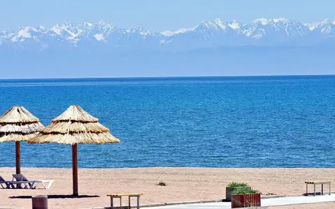

The lake, not the oblast or whole mountain basin
Lake Issyk-Kul is the established English name. Scientific publications also use Issyk Kul without a hyphen, while the International Lake Environment Committee record uses the transliteration Lake Issyk-Kool. This page covers the standing-water body, its submerged basin, and the drainage processes that directly shape it. It does not use “Issyk-Kul” to mean the surrounding administrative region, the wider intermontane basin, or every part of the Tian Shan.[1]
The lake lies wholly within Kyrgyzstan. The Kungey Ala-Too forms the northern mountain wall and the higher Terskey Ala-Too the southern wall. At the western end, the shore narrows near Balykchy and the Kutemaldy threshold, close to the Chu River's turn toward Boom Gorge. At the eastern end, the Tyup and Jyrgalan approach along the basin axis and build a broad, low sedimentary margin. This arrangement explains why the north and south shores are comparatively steep while the ends contain wide platforms and former river courses.[2][4]
Dimensions tied to bathymetry and lake level
The 2002 bathymetric synthesis reports an east-west length of 178 km, width of about 60 km, surface area of 6,236 km², 688 km of shoreline, mean depth of about 278 m, maximum depth of 668 m, and volume of 1,736 km³. It combined existing depth data with 990 km of high-resolution reflection-seismic profiles collected in 1997 and sediment cores collected in 1998. The dimensions therefore describe a mapped lake surface and bed, not a current satellite shoreline or one straight survey line.[2]
Published summaries are not perfectly consistent. The World Lake Database gives the same area and maximum depth but lists 1,738 km³ of water and 270 m mean depth. Its area and volume would imply a mean near 279 m, so this record uses the internally consistent 278 m bathymetric value and treats the 2 km³ volume difference as source precision or rounding. For length, it uses the explicitly defined 178 km east-west measurement rather than combining it with route-undefined figures.[1][2]
Surface elevation is variable rather than a fixed property. The database's 1,606 m figure is explicitly dated to 1990, while the bathymetric chapter rounded the setting to 1,607 m. Neither should be read as today's exact gauge level; recent monitoring uses both ground gauges and satellite altimetry in several height systems.[1][7]
Two broad platforms, steep slopes, and a deep plain
Issyk-Kul is not a uniformly deep bowl. Gently dipping platforms extend about 40 km from the western shore and 60 km from the eastern shore, reaching roughly 300 m water depth and together occupying about half the lake floor. Their upper parts are mostly shallower than 50 m. A conspicuous break at about 110 m separates those shallow surfaces from lower terraces before the bed drops down steep slopes to water deeper than 600 m.[2]
Channels 2–3 km wide and as much as 50 m deep cut the shallow platforms. On the east, a main channel connects to the Jyrgalan mouth and another to the Chong-Kyzyl-Suu. Submerged channels on the west point toward former Chu River mouths. These channels end near the 110 m break, preserving river-cut topography formed when lake level and drainage geometry differed from today.[2]
Relict delta platform
Buried and exposed delta lobes record sediment supplied when the Chu was connected to the lake.
Active river-built platform
The Jyrgalan and Tyup deliver most present terrigenous sediment and build overlapping delta deposits.
Flat floor below 600 m
Fine sediment, mass-flow deposits, bottom-current features, and a young folded ridge occupy the axial deep.
The narrow northern and southern margins are much steeper. Seismic profiles show slope-failure deposits at their bases, while the deep eastern floor contains debris-flow lenses and an anticlinal ridge—an upfold in layered sediment—cut by a fault. River supply, gravity-driven sediment movement, bottom currents, and continuing crustal shortening all contribute to the present bed.[2][4]
Mountain growth, subsidence, and staged lake formation
The Issyk-Kul depression is an intermontane basin within the actively shortening northern Tian Shan. As the ranges rose and converged, deformation created accommodation space—the low ground available for sediment and water—between the Kungey and Terskey ranges. Rivers then filled the basin margins with alluvial, fluvial, and glacial-outwash sediment while deep water persisted over the subsiding center. Folding, faults, and earthquakes show that deformation has not ended.[3][4]
An older database description assigns the lake an age of 20 million years, but recent dated terrestrial sections do not support treating that as the age of the modern water body. Magnetostratigraphy and cosmogenic-nuclide burial ages published in 2023 place the commencement of lake formation at about 5 million years ago, after tectonic reorganization and increasing subsidence on the southern side of the basin. That date marks the start of lacustrine development in a changing basin, not the creation day of the present shoreline, depth, or salinity.[1][3]
Mountain inflow ends in evaporation
The database's 15,844 km² catchment figure describes land draining toward the lake. Adding the 6,236 km² water surface gives 22,080 km² for the whole closed basin, which explains the larger figure used in several scientific papers. The two numbers are therefore different boundary conventions, not competing measurements of the same area.[1][2]
About 118 rivers and streams have been counted within that drainage network. Snowmelt, glacier melt, rain, and groundwater feed them, but many small streams infiltrate coarse piedmont deposits or are diverted before reaching the shore. The Tyup and Jyrgalan are the principal surface inflows and enter across the eastern platform; shorter catchments descend directly from the north and south ranges.[2][4]
With no modern surface outlet, the lake loses water mainly through evaporation. A water-balance model calibrated with 1980–2012 hydro-meteorological data used mean annual natural runoff of 2.421 km³, direct precipitation of 313 mm over the lake, and lake-surface evaporation of 934 mm. These are period means assembled for that model, not timeless constants; year-to-year river flow, precipitation, evaporation, groundwater exchange, and tributary withdrawals alter the balance.[6]
A closed lake beside a former through-flow route
The upper Chu once entered the western lake and water left toward the lower Chu system. Tectonic deformation near the western basin margin is inferred to have diverted the river toward Boom Gorge late in the Pleistocene. The abandoned western channels and large delta bodies are physical evidence of that earlier connection, although the precise sequence of diversion and overflow remains reconstructed rather than directly observed.[2][4]
Published estimates place the western overflow threshold at about 1,620–1,622 m elevation, roughly 14–16 m above the database's 1990 lake level. The small difference reflects source mapping and reference precision. Syntheses also differ on the last historical overflow, placing it in the eighteenth or nineteenth century; the dependable conclusion is that the Chu no longer passes through the lake and the modern water balance is endorheic.[2][4]
A dry western shore, wetter east, and winter renewal
Westerly air crosses a long mountain-enclosed basin, producing a strong west-to-east moisture gradient. A 2023 sediment study summarizes annual precipitation near Balykchy on the western shore at about 120 mm and near Karakol in the east at about 720 mm. That contrast helps explain sparse western runoff and the larger eastern river and delta system. High terrain stores part of the mountain precipitation as seasonal snow and glacier ice before releasing it to tributaries.[4]
Issyk-Kul is slightly saline, at roughly 6 g of dissolved salts per kilogram of water—far below ocean salinity. It is commonly classified as warm monomictic: it develops a warm-season thermocline, or layer of rapid temperature change, and undergoes its principal full-depth renewal during winter rather than freezing over as one continuous sheet. Shallow bays can freeze, but the deep main body retains heat and remains open.[1][4][5]
Modern studies place the seasonal thermocline roughly between 70 and 125 m.[4] Profiles collected in 2015–2017 found only small salinity differences across most open water. Near the eastern river mouths, fresher shelf water cools in winter and can descend through submerged river channels into the deep basin. This differential cooling renews deep water; the same surveys found the water column oxygenated to the bottom. Wind-driven circulation, shelf geometry, weak salinity gradients, and winter heat loss therefore work together rather than as separate lake traits.[5]
Long-term decline interrupted by multi-year rises
Lake area, shoreline position, and elevation should not be presented as fixed. CAIAG's combination of Kyrgyzhydromet gauges and satellite altimetry found a 3.22 m decrease from 1927 to 2023, but the path was not steady: the lake rose about 0.8 m from 1998 to 2004, then fluctuated during a relatively stable 2004–2017 interval before declining again through 2023.[7]
A CAIAG update based on data through 30 March 2026 reported the level back near its 1998 position: it had risen and then fallen with no net 1998–2026 decline, even though the longer record still trends downward. Gauge heights use the Baltic height system, while satellite products use geoid models such as EGM2008 and EIGEN-6C; absolute elevations from those series should not be combined without transformation. The physically important point is measured variability on seasonal, multi-year, and decadal scales, not one timeless surface elevation.[7][8]
From mountain runoff to a terminal basin
Lake Issyk-Kul belongs in the lake hub as a deep endorheic water body whose form depends on active mountain-basin deformation. The Kungey and Terskey catchments connect it to the mountain hub; the Tyup, Jyrgalan, and former Chu route connect it to the river systems hub. Its fault slopes, deltas, submerged channels, terraces, and mass-flow deposits connect it to the terrain index.
Sources and measurement notes
- International Lake Environment Committee, Lake Issyk-Kool, World Lake Database record ASI-55 (profile data chiefly through 1990; accessed 29 August 2026). Source for the Issyk-Kool/Issyk Kul aliases, Kyrgyz location, 1990 elevation, 6,236 km² surface, 688 km shoreline, 15,844 km² land catchment, 1,738 km³ listed volume, salinity and mixing context. Its 270 m mean-depth entry is inconsistent with its own area and volume and is not used here.
- De Batist, M. et al., “Bathymetry and Sedimentary Environments of Lake Issyk-Kul, Kyrgyz Republic (Central Asia): A Large, High-Altitude, Tectonic Lake”, in Lake Issyk-Kul: Its Natural Environment, pp. 101–123 (2002). Source for the approximate map position; 178 × 60 km extent; 6,236 km² area; 278 m mean and 668 m maximum depth; 1,736 km³ volume; 1997 seismic-survey method; western and eastern platforms; channels, slopes, deep basin and sediment environments; tributaries; and former Chu connection.
- Kudriavtseva, A. et al., “Neogene aridification and lake development in the Issyk-Kul basin, Kyrgyzstan”, Basin Research 35, 1193–1227 (2023). Source for dated Tian Shan growth, basin aridification, increased southern subsidence, river reorganization, and the estimated start of lake formation at about 5 Ma. This newer chronology is preferred to the older database's unqualified 20 Ma age.
- Lenz, J. et al., “Modern Sedimentation Patterns in Lake Issyk Kul (Kyrgyzstan), Derived From Surface Sediment and Inlet Stream Samples”, Earth and Space Science 10, e2022EA002541 (2023). Source for the active compressional setting, mountain margins, modern sediment pathways, 118 inlets, land catchment interpretation, Tyup and Jyrgalan inflows, loss of smaller streams, closed drainage, approximately 6 g kg−1 salinity, west-east precipitation gradient, and western overflow-threshold and historical-outlet context.
- Zavialov, P. O. et al., “New profiling and mooring records help to assess variability of Lake Issyk-Kul and reveal unknown features of its thermohaline structure”, Hydrology and Earth System Sciences 22, 6279–6295 (2018). Source for the 2015–2017 CTD and mooring methods, the evidence supporting 668 m over competing maximum-depth claims, salinity structure, fully oxygenated deep water, and winter advection through eastern submerged riverbeds.
- Alifujiang, Y. et al., “System Dynamics Modeling of Water Level Variations of Lake Issyk-Kul, Kyrgyzstan”, Water 9, 989 (2017). Source for the 1980–2012 calibrated water-balance period and its mean annual natural runoff, precipitation, and lake-surface evaporation. These values are explicitly retained as study-period model inputs rather than current constants.
- Mandychev, A. N., Central-Asian Institute for Applied Geosciences, Monitoring Long-Term Variation in Level of Lakes Issyk-Kul and Chatyr-Kul Based on Measurements with Altimetry Instruments and Optical Images of Satellites (2023 report; figures include satellite data through 2024; accessed 29 August 2026). Source for gauge and altimetry methods, vertical reference systems, 1927–2023 net level change, the 1998–2004 rise, and subsequent fluctuations.
- Central-Asian Institute for Applied Geosciences, “CAIAG specialists confirm that nothing unusual is happening with the water level of Lake Issyk-Kul” (8 April 2026; data through 30 March 2026; accessed 29 August 2026). Source for the statement that the 2026 level had returned close to its 1998 position, the absence of a net 1998–2026 decline, ongoing station monitoring, and the distinction between seasonal, multi-year, and long-term change.