
One desert, several mapped extents
“Chihuahuan Desert” and Desierto Chihuahuense name a physical desert region and, in many sources, an ecoregion. Neither name identifies one surveyed landform with a universally accepted perimeter. A climate-based study drew the desert using the de Martonne aridity index; its resulting arid zone was reported as 357,000 km². The National Park Service uses a much broader, nearly 647,500-km² ecoregion that includes desert grassland, shrubland and higher mountain environments.[1][2]
The two figures therefore measure different things, not a change in the desert's size. This record uses the broader name for regional orientation but labels measurements from the narrower climatic polygon. It does not treat the geological Chihuahua Trough, the state of Chihuahua, the Bolsón de Mapimí, the Chihuahuan Deserts ecoregion in the United States, or the entire Mexican Plateau as interchangeable with the desert. For the same reason, a single “centre coordinate” would imply false precision and is not given.
Between the Sierra Madres
The broad NPS frame runs nearly 1,500 km from south of Albuquerque to a point about 250 km north of Mexico City. It includes parts of Chihuahua, Coahuila, Durango, Zacatecas, Nuevo León and San Luis Potosí in Mexico, plus Trans-Pecos Texas, southern New Mexico and the southeastern corner of Arizona; more than 90% of that mapped ecoregion is in Mexico.[1] These administrative names locate the region but do not define its natural edges.
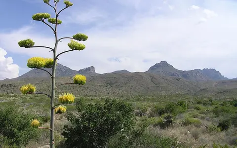
Physically, the desert occupies high interior country between the Sierra Madre Occidental on the west and the Sierra Madre Oriental on the east. The mountain chains are not continuous walls, especially toward the north, and the desert contains many isolated ranges of its own. Southward, cross-ranges in Coahuila and Zacatecas interrupt the plateau; northward, the terrain opens into the Rio Grande Rift, Basin and Range country and higher semiarid grasslands. The Sonoran Desert lies beyond the western uplands, while more humid Gulf-facing slopes mark a different eastern setting.
Coalescing basins, resistant ranges
Schmidt's climate-defined desert has basin floors generally near 900–1,200 m, with many mountain summits standing about 600–1,200 m above adjacent Quaternary alluvium. His map analysis placed nearly 12% of that polygon above 1,800 m, the climatic upper limit used in the study.[2] Those numbers describe a particular mapped desert core; the broader ecoregion includes both lower Rio Grande valleys and mountains above that limit.
The rock framework changes across the region. Cretaceous limestone is prominent in many central and eastern ranges, while Cenozoic volcanic rocks are common toward the west and north. In the Guadalupe Mountains, uplift exposes the Permian Capitan reef and related carbonate rocks; Big Bend preserves Cretaceous strata, younger volcanic rocks and alluvium. These examples show why “limestone desert” is useful locally but too simple for the whole Chihuahuan.[3]
In the northern sector, late-Cenozoic crustal extension helped separate uplifted blocks from subsiding basins. The Rio Grande Rift has operated since the late Oligocene, roughly 30 million years ago; a gravity-model study estimated about 24 km of extension at 33°N in southern New Mexico, but assigned uncertainty as large as ±60%.[4] Erosion then carries rock debris from steep fronts onto alluvial fans. Where neighboring fans merge, they make a bajada; finer sediment continues toward the basin axis.
A sediment-filled intermontane low
A bolson is a broad basin or constructional plain between uplands. Some are closed; others have weak or integrated outlets.
Coalesced alluvial fans
Gravel, sand and silt spread below mountain canyons until adjacent fan aprons join along a range front.
An intermittently flooded basin floor
Fine sediment and salts collect at a closed low that may hold shallow water after storms and dry again by infiltration and evaporation.
Internal basins beside through-flowing rivers
Drainage is divided rather than uniformly closed. Schmidt's map-based estimate associated nearly two-thirds of the climate-defined desert with interior-drainage basins.[2] The Bolsón de Mapimí is a major southern example: Mexico's INEGI describes it as a closed depression of the Sierras y Llanuras del Norte, receiving intermittent rivers and arroyos generated by short, widely separated summer downpours.[5] Tularosa Basin in New Mexico is another terminal system.[6]
Closed drainage is not the whole story. In the United States, substantial areas belong to the Rio Grande and Pecos drainage systems; in Mexico, the Río Conchos crosses the plateau and joins the Rio Grande–Río Bravo at Ojinaga–Presidio.[2][3] These rivers connect mountain catchments and desert valleys to the Gulf of Mexico even when tributary arroyos are dry. Thus a bolson should not automatically be called endorheic: its outlet and modern drainage integration must be checked basin by basin.
During intense rain, shallow sheetflow and channel flow move sediment across fans and can briefly flood a playa. Coarse fan deposits absorb part of that water; other water evaporates or percolates into basin fill. Repeated concentration of dissolved ions produces saline mud, carbonate, gypsum and other evaporites in terminal lows. Springs and shallow groundwater can therefore occur within a desert whose dependable surface flow is sparse.
From pluvial lake to White Sands
Tularosa Basin demonstrates how rock, water, climate and wind combine. During the wetter late Pleistocene, runoff from the San Andres and Sacramento mountains carried dissolved gypsum into Lake Otero, which covered about 1,600 square miles (approximately 4,100 km²). As the climate warmed and the lake contracted about 12,000 years ago, gypsum crystallized on the exposed floor; wind and weathering broke and transported the crystals into dunes.[6]
The resulting White Sands dunefield covers 275 square miles (442 km²), measures about 16 by 48 km and contains dunes up to roughly 18 m high in the NPS park-statistics inventory.[6] These are measurements of one dunefield, not the Chihuahuan Desert. Modern Lake Lucero still ponds after heavy rain over an area of about 16 km², and groundwater helps keep gypsum available and stabilizes parts of the field. The example explains the process behind the desert's gypsum terrain without implying that most of its surface is sand.
Summer rain, dry spring, cold northern incursions
Aridity results from several controls acting together. The Sierra Madre ranges intercept ocean-derived air on their outer slopes; the interior lies roughly 400–700 km from the Gulf of Mexico and eastern tropical Pacific in Schmidt's analysis; subtropical high pressure suppresses uplift for much of the year; and strong sunshine sustains a large evaporative demand. Elevation makes the Chihuahuan cooler than many lower subtropical deserts, while northern basins remain exposed to winter cold fronts.[2]
A 1986 regional synthesis based on about 140 desert weather stations reported a mean annual precipitation of 235 mm and station means of roughly 150–400 mm. More than 70% of annual precipitation fell from May through October at nearly all stations, usually peaking in July and August; spring was the driest season. These figures combine historical station records—some Mexican source normals covered 1941–1970—and are a defined research climatology, not a current normal for every locality. The NPS's broader ecoregion summary gives a wider 150–500-mm annual range but does not specify a normal period.[1][2]
For the northern U.S. desert, an independent analysis of daily records from 22 U.S. Historical Climatology Network sites for 1910–2010 found that July–September monsoon rain supplied about 40–50% of annual precipitation on average. The same study found strong local variability and showed that a small number of large events can dominate a season.[7] A regional rainfall value should therefore not be read as the likely total at a particular basin, mountain or year.
Storm pulses, sediment and dust
Short-lived storms do disproportionate geomorphic work. Runoff cuts arroyos, shifts fan channels and carries coarse debris away from range fronts; ponding lays down finer sediment in basin lows. When those surfaces dry, wind can remobilize sand and silt. Vegetation, surface crusts, groundwater depth and recent flooding determine whether a surface resists or emits sediment.
A 2016 study compared mapped landforms with a decade-scale MODIS Deep Blue satellite record of airborne dust over the Chihuahuan Desert. The observed differences among surface types broadly followed the geomorphic dust-source model, although the model overpredicted low-level persistent emission from alluvial surfaces.[8] The result supports a process-based reading of the desert: playas, fans and dune fields do not respond alike, and dust activity can change after flooding, drying or surface disturbance.
The late-Pleistocene Lake Otero record also shows that present aridity is not a timeless landscape state. Cooler, wetter intervals expanded lakes and wetlands; subsequent drying exposed mineral sediment to wind. Modern storm ponding, salt crystallization, dune migration and dust emission continue the same exchange among water, sediment and atmosphere at much shorter time scales.
Follow the boundaries and outlets
Use the Rio Grande record to follow the principal external river corridor from New Mexico through the El Paso–Ciudad Juárez basin and along the international boundary. Compare the Sonoran Desert west of the Sierra Madre Occidental and the Mojave Desert farther northwest to see how elevation and seasonal rainfall distinguish neighboring North American drylands.
For category-wide navigation, return to the Desert Hub. These links are geographic comparisons, not claims that ecoregion boundaries meet along simple lines.
Sources and measurement notes
- U.S. National Park Service, Chihuahuan Desert Inventory & Monitoring Network, “Chihuahuan Desert Ecoregion” (updated 20 January 2022; accessed 29 August 2026). Source for the broader 647,500-km² ecoregion, its nearly 1,500-km north–south reach, national and state distribution, generalized 150–500-mm precipitation range and basin-and-range setting. The page does not identify a rainfall-normal period.
- Schmidt, R. H., Jr., “Chihuahuan Climate”, in Barlow, J. C., Powell, A. M. & Timmermann, B. N. (eds.), Chihuahuan Desert—U.S. and Mexico II, pp. 40–63 (Chihuahuan Desert Research Institute, 1986). Used for the de Martonne climate boundary, 357,000-km² area, more-than-11° latitudinal span, basin elevations and relief, internal-drainage estimate, rock pattern, climate controls and station-based precipitation statistics. The synthesis used about 140 stations and historical source records; its figures are not presented as modern climate normals.
- U.S. National Park Service, “Geodiversity Atlas—Chihuahuan Desert I&M Network Index” (accessed 29 August 2026). Used for the basin-and-range, playa and dune setting, U.S. Rio Grande–Pecos drainage context and examples of Permian, Cretaceous, Cenozoic volcanic and Quaternary geology. The detailed geology covers seven park units in southeastern New Mexico and west Texas, not every part of the desert.
- Cordell, L., “Extension in the Rio Grande rift”, Journal of Geophysical Research: Solid Earth 87(B10), 8561–8569 (1982); USGS publication record. Source for the late-Oligocene-to-present duration and modeled 24-km extension at 33°N. The author's uncertainty of up to ±60% is retained in the text.
- Instituto Nacional de Estadística y Geografía (INEGI), Síntesis de Información Geográfica del Estado de Chihuahua, historical digital extract (accessed 29 August 2026). Used only for the physical description of the Bolsón de Mapimí as a closed basin in the Sierras y Llanuras del Norte and for its intermittent summer runoff.
- U.S. National Park Service, White Sands National Park, “Lake Lucero” (updated 13 November 2024) and “Park Statistics” (updated 17 June 2024); accessed 29 August 2026. Used for the explicitly local Lake Otero, Lake Lucero and gypsum-cycle history, and for the dunefield's 442-km² area, dimensions and dune height.
- Petrie, M. D., Collins, S. L., Gutzler, D. S. & Moore, D. M., “Regional trends and local variability in monsoon precipitation in the northern Chihuahuan Desert, USA”, Journal of Arid Environments 103, 63–70 (2014). The study analyzed daily data from 22 U.S. Historical Climatology Network sites for 1910–2010; its 40–50% monsoon share applies to the northern U.S. study region.
- Baddock, M. C., Ginoux, P., Bullard, J. E. & Gill, T. E., “Do MODIS-defined dust sources have a geomorphological signature?”, Geophysical Research Letters 43, 2606–2613 (2016); abstract and archived manuscript at the NOAA Institutional Repository. Used for the comparison between geomorphic source classes and MODIS Deep Blue Collection 6 dust loading, including the stated model limitation for alluvial surfaces.