
A flooded caldera and island-ring landform
Santorini adds a caldera record where eruption, collapse, marine flooding, and island remnants create one visible volcanic basin.
What Santorini Caldera is
Santorini Caldera is a volcanic basin in the Aegean Sea. Its rim islands and steep cliffs mark the outline of a collapsed volcanic center.
The record is useful because it connects explosive volcanism, caldera collapse, marine flooding, and island landform structure.
Collapse basin, cliffs, and island remnants
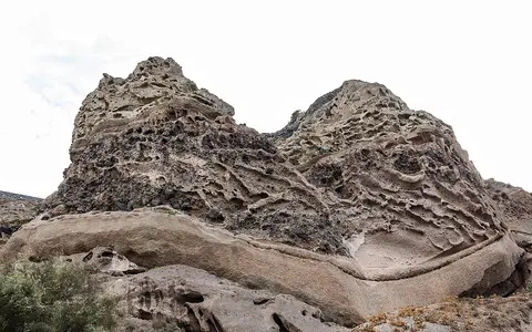
The caldera rim exposes volcanic layers and collapse geometry. Central islands and deposits show that volcanic activity continued after the main collapse.
Caldera cliffs
Steep walls reveal layered volcanic deposits.
Marine flooding
Sea water fills the collapse structure.
Aegean setting
The caldera belongs to a regional volcanic arc.
Repeated collapse and the record in the cliffs
Santorini’s basin developed through repeated episodes of volcanic construction and collapse. The Smithsonian’s geological summary identifies at least four partly overlapping calderas: an oldest southern structure formed about 180,000 years ago, followed by Skaros about 70,000 years ago and Cape Riva about 21,000 years ago. The youngest formed during the Late Bronze Age eruption, approximately 3,600 years ago. These approximate ages distinguish successive stages of the landscape; the island ring is not simply the surviving edge of a single eruption.
The cliffs also preserve evidence of different eruptive processes. Exposures described by the Smithsonian include early pumice-fall deposits, laminated deposits from pyroclastic surges involving water, and overlying pyroclastic-flow deposits. Their order records changes during an eruption, while older layers beneath them preserve earlier volcanic episodes. The visible walls therefore provide a cross section through the volcano’s history as well as an outline of its collapse basin. Reading the caldera requires both scales: the arrangement of islands across the bay and the succession of deposits exposed in individual cliffs. Source: Smithsonian Global Volcanism Program.
Reading the rim and the central islands
NASA’s astronaut photograph places Santorini approximately 118 kilometers north of Crete and shows how its settlements follow the volcanic topography. On Thera, the steep western shoreline marks the caldera rim. White roofs trace the cliff edge, overlooking the water and the smaller islands within the bay. This arrangement makes the distinction between the outer rim and the central volcanic landforms especially clear: the cliffs define the basin’s margin, while the islands inside it record subsequent growth.
Nea Kameni and Palaea Kameni formed from lava domes and flows after the Bronze Age eruption. In the photograph, irregular brown and dark-brown masses on Nea Kameni reveal the outlines of several flows. Those surfaces represent additions of volcanic material within an older depression. They explain why a flooded caldera can contain younger volcanic islands rather than remaining an uninterrupted expanse of water.
NASA’s account describes small explosions and lava production in 1950. That episode illustrates the difference between the large eruption associated with the present caldera and later activity that built or modified land inside it. Source: NASA Earth Observatory, 2008.
A landscape preserved above and below water
The Bronze Age eruption changed both the physical landscape and the evidence available for studying its inhabitants. NASA’s account describes ash carried tens of kilometers into the atmosphere, destructive debris flows and tsunamis, and a deep caldera partly flooded by the Aegean Sea. At Akrotiri, several meters of ash and other erupted material buried the settlement. Burial was destructive, but it also preserved buildings and objects that would otherwise have remained exposed to weathering and later disturbance.
Excavations beginning in 1967 have revealed multistory buildings, roads, irrigation systems, furniture, pottery, and frescoes. These remains give the eruption a human geographical context: the volcanic deposits cover an inhabited landscape, rather than an empty island. They also provide a different record from the cliffs, preserving details of settlement alongside the geological evidence.
The submerged landscape offers another field of investigation. Around Santorini and nearby underwater volcanoes, researchers have explored complex seabed terrain and hydrothermal vents with robotic submersibles. Together, the archaeological site and underwater investigations show why the visible island ring represents only part of the evidence preserved here. Source: NASA Earth Observatory, 2025.
Sources
- Smithsonian Institution, Global Volcanism Program — Santorini: geological summary and descriptions of volcanic deposits.
- NASA Earth Observatory — Santorini Volcano, Greece, June 30, 2008: island geography and post-caldera volcanism.
- NASA Earth Observatory — Santorini’s Hidden Worlds, July 10, 2025: Bronze Age deposits, Akrotiri, and underwater exploration.