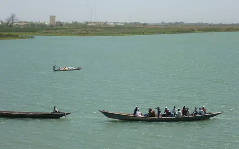

What the Senegal River is
The Senegal River is a major western African drainage system shared by Guinea, Mali, Mauritania, and Senegal. Its longest headwater, the Bafing, rises in the Fouta Djallon of Guinea. The Bafing meets the Bakoye at Bafoulabé in Mali, forming the named river, which continues generally northwest and west to the Atlantic.
Below the upper basin, the river becomes the boundary between Senegal and Mauritania for much of its lower course. This long valley crosses dry Sahelian terrain where local rainfall supplies comparatively little flow, making water delivered from the wetter southern headwaters central to the river's hydrology.
From upland tributaries to the lower valley
The Bafing descends from dissected uplands in northern Guinea and enters western Mali. The Bakoye approaches from the east after draining lower uplands along the western side of the upper Niger watershed. Their meeting at Bafoulabé marks the start of the Senegal proper.
Downstream, the channel passes through the Kayes region and receives the Falémé, another Fouta Djallon tributary and the last major humid-basin inflow. Near Bakel the river leaves the more varied relief of the upper basin and enters a broad, low-gradient alluvial valley. It then arcs westward between Mauritania and Senegal toward the delta near Saint-Louis.
A narrowing gradient and broad floodplain
The upper catchment contains plateaus, rocky valleys, and steeper tributary slopes that concentrate seasonal runoff. Farther north and west, relief becomes subdued. The lower channel occupies an alluvial corridor bordered by natural levees, clay-rich flood basins, abandoned channels, and low terraces.
Before large-scale regulation, the annual rise regularly spilled into the floodplain, locally known as the waalo. Water spread through side channels and shallow depressions before draining or evaporating as river levels fell. The surrounding higher and drier ground lies beyond the frequently inundated zone.
Upland runoff
The Bafing, Bakoye, and Falémé gather most river water from the wetter south.
Alluvial floodplain
A gentle gradient favors meanders, levees, flood basins, and seasonal overflow.
Delta and estuary
Low wetlands and distributary channels meet an Atlantic shore shaped by waves and sand.
Monsoon rainfall and a delayed flood pulse
Rainfall varies sharply across the basin. The Fouta Djallon and southern upper basin receive a pronounced wet season, while the lower valley and northern basin are much drier and lose substantial water through evaporation. Runoff generated upstream produces a flood that moves down the river during the late northern summer and autumn, commonly reaching its seasonal maximum downstream after the principal rains have begun in the headwaters.
The Bafing is the dominant source stream, while the Bakoye and Falémé add important seasonal flow. Smaller tributaries entering from the dry north and south are more intermittent. Lake Guiers in Senegal and Lake R'Kiz in Mauritania connect with the lower-river system through channels and depressions, extending its hydrologic influence beyond the main bed.
Dams and the modern river regime
The Manantali Dam on the Bafing stores upper-basin water, while the Diama Dam near the head of the delta limits the upstream movement of Atlantic salt water. Together with embankments and irrigation channels, these structures have altered the timing, reach, and duration of flooding along parts of the valley and delta.
Regulation does not remove the basin's climatic controls, but it changes how water moves through them. Reservoir releases can support dry-season flow, while managed water levels and flood releases differ from the highly variable natural pulse. The present river is therefore shaped by both regional rainfall and engineered storage.
Low wetlands at the Atlantic margin
Near the coast, the valley opens into a very low delta of channels, lakes, backwaters, marshes, and seasonally inundated flats. Much of this terrain stands only a few metres above sea level. The Djoudj wetland occupies part of the lower delta, while other channels distribute river water across both sides of the international boundary.
The river reaches the Atlantic south of Saint-Louis through a coastal setting strongly influenced by sand transport, waves, and the elongated barrier landform known as the Langue de Barbarie. Unlike a broad protruding delta with many open sea mouths, the Senegal's outlet is constrained along a sandy coast. River discharge, marine processes, and human modifications all affect the position and form of this final reach.