
Basin logic
The Nile connects tropical headwaters, highland tributaries, extensive wetlands and a desert river corridor before reaching the Mediterranean Sea. Its drainage basin is the land contributing water to this connected system, rather than simply the strip beside the main channel. The Nile Basin Initiative describes a catchment of about 3.2 million square kilometres. This basin perspective explains how rainfall far from Egypt can sustain a river flowing through much drier country downstream.
The White Nile and Blue Nile are its two principal branches. The White Nile’s upstream catchments include rivers originating in Burundi and Rwanda; the Blue Nile originates in Ethiopia. Other tributaries include the Sobat, draining parts of southwestern Ethiopia and eastern South Sudan, and the Bahr el Ghazal, draining western South Sudan. These connections make the Nile a network of contributing landscapes with different flow regimes. Source: Nile Basin Initiative.
Lakes, wetlands and the White Nile
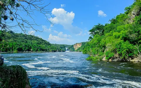
The equatorial branch links rivers with large lakes. The Victoria Nile carries water from the Lake Victoria and Lake Kyoga system into the northern end of Lake Albert, near the Albert Nile outlet. Lake Albert also receives the Semliki River from Lake Edward. Following these connections avoids treating a single lake as the whole source region: the water reaching the outlet has travelled through several catchments and storage areas.
Farther north, the river enters the shallow Sudd depression in South Sudan. Here the landscape opens into channels, swamps and seasonally flooded grasslands. Wetland extent changes with seasonal flooding and variations in inflow between years. Evaporation and water released by vegetation reduce the amount continuing downstream, while the wetland system moderates fluctuations in outflow. The Sudd therefore helps explain why upstream rainfall and downstream discharge cannot be treated as interchangeable measurements. Source: Upper Nile ecoregion account.
Confluences and the desert corridor
At Khartoum in Sudan, the White Nile meets the Blue Nile. The Blue Nile descends from the Ethiopian highlands through a deep canyon before reaching the Sudanese plains. Highland rainfall supplies a strongly seasonal contribution to the combined river. The Atbara, another river originating in the Ethiopian highlands, joins farther downstream. These junctions bring together waters from contrasting environments and help account for the historical seasonal flood of the lower Nile.
Beyond the Atbara, the river traverses the deserts of northern Sudan and Egypt. Its course includes rocky cataract reaches and the reservoir known as Lake Nubia in Sudan and Lake Nasser in Egypt. Below Aswan, the valley is confined by steep sides. This sequence shows why the lower Nile is not a uniform floodplain: channel conditions change between rocky reaches, reservoir waters and the valley downstream. Source: Lower Nile ecoregion account.
Floodplain sediment and river regulation
Historically, annual floods carried silt onto agricultural land and supplied sediment to the delta. The Aswan High Dam changed both processes. Its reservoir stores water and traps sediment, while controlled releases reduce downstream flooding. NASA’s account of the dam describes benefits from electricity generation and flood control alongside reduced natural replenishment of agricultural soils and coastal sediment. The distinction matters when reading the landscape: a floodplain formed through repeated inundation does not necessarily retain that same flooding pattern under river regulation. Source: NASA, Aswan High Dam.
The delta and Mediterranean coast
Near Cairo, the valley opens into the Nile Delta, a broad triangular lowland extending to the Mediterranean. Its two main river branches are Rosetta in the west and Damietta in the east. These are distributaries, carrying water away from the main river toward the sea. This reverses the pattern at upstream tributary junctions, where separate streams combine into a larger channel.
The delta also contains cultivated land, marshes and coastal lakes, including Manzala, Burullus and Idku. Its shape reflects the balance between sediment arriving from inland and material redistributed along the coast. Reduced sediment delivery, coastal erosion and seawater infiltration help explain why the delta cannot be understood solely as the river’s endpoint. It is a changing meeting place of river flow, lowland soils and marine processes. Source: Nile Delta ecoregion account.