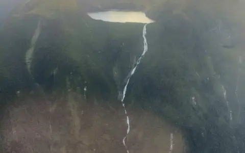

What Browne Falls is
Browne Falls is the steep outlet stream of Lake Browne in Fiordland National Park, on the southwest of New Zealand's South Island. The lake occupies high ground immediately west of the main channel of Doubtful Sound/Patea. From its outlet, water descends the mountainside opposite Elizabeth Island and reaches the fiord close to sea level.
The named feature is not a single vertical ribbon. It is a series of falls dispersed among cascades, with much of the water remaining in contact with sloping bedrock. That distinction explains why Browne Falls is often described as a cascade and why comparisons with more clearly bounded waterfalls require care.
Measuring a long, broken descent
Topographic descriptions place Lake Browne at roughly 828 metres above sea level, while the widely repeated total-drop figure is 836 metres. A lower figure of about 619 metres also appears in published descriptions. These values may reflect different choices about the upper and lower limits of the named falls, map elevation, and which portions of the channel count as waterfall rather than steep stream.
It is therefore most useful to separate two geographic facts: the lake stands more than 800 metres above the fiord, and the connecting channel contains multiple falls and cascades over that descent. Claims that Browne Falls is definitively New Zealand's highest waterfall depend on definition and are disputed, particularly because very little of the course is a continuous free fall.
Perched lake
Lake Browne stores runoff on high ground above the fiord wall.
Broken cascade
The outlet follows a steep, irregular course across rock and forested terrain.
Marine outlet
The stream completes its descent at the tidal waters of Doubtful Sound/Patea.
A waterfall on a glacially cut valley wall
Fiordland is built largely from resistant crystalline rocks, including gneiss, schist, and granite, and has been repeatedly uplifted, faulted, and glaciated. During the Pleistocene, large glaciers excavated deep U-shaped valleys through this rugged terrain. After the ice retreated and sea level rose, the lower valley of Doubtful Sound/Patea was flooded by the sea.
Smaller tributary basins were not cut as deeply as the main glacier trough. Lake Browne and its outlet occupy this hanging topographic position above the fiord. The abrupt difference in elevation between the upland basin and the over-deepened main valley produces the long cascade. Rock steps, fractures, shallow gullies, and slope debris divide the flow into successive reaches.
Lake storage and rain-responsive flow
Lake Browne gathers precipitation and short inflowing streams from a compact mountain catchment. The lake provides some storage, but the discharge of its outlet remains tied to conditions in that small basin. Prolonged rain raises inflow and strengthens the cascade; drier intervals expose more of the bedrock course and reduce the visible water volume.
This response is typical of Fiordland's steep coastal catchments. Short travel distances and thin mountain soils allow rainfall to reach channels quickly. Browne Falls is more persistent than the temporary streaks that appear on many fiord walls after storms because it has a lake source, yet its flow still varies substantially with rainfall and lake level.
Moist westerlies against steep mountains
Fiordland lies directly in the path of moisture-bearing westerly winds from the Tasman Sea. As that air rises across the mountains, it cools and produces frequent, heavy orographic precipitation. The resulting wet temperate climate supplies dense forest on lower slopes, high runoff, and an exceptional concentration of waterfalls.
Season and weather alter the form of the falls more than they alter the underlying landform. Rain can turn separated threads into a broad, energetic cascade, while calmer periods reveal the stepped channel. The physical framework—a perched basin above a deeply excavated fiord—continues to control the route in either condition.
From mountain basin to Tasman Sea
Browne Falls forms a very short drainage connection. Water moves from Lake Browne through the steep outlet, enters the saline waters of Doubtful Sound/Patea, and ultimately reaches the Tasman Sea through the fiord's outer channels. Unlike a waterfall on a long river, it has almost no lower freshwater course.
The record links the waterfalls hub with the lakes hub and the terrain index. Together with Sutherland Falls, it shows how upland lake storage, glacial valley relief, and Fiordland rainfall combine to create exceptionally long waterfall descents.